Sarjapur Road Pin Code And Connectivity Guide
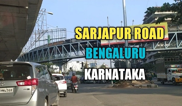
Sarjapur Road is one of Bangalore busiest and fastest-growing corridors. From multinational IT parks to shopping malls and top schools, this stretch has it all. To send a letter or plan your daily travel, you need the right Sarjapur Road PIN code, plus a clear picture of connectivity by road, bus, metro, rail, and air. In this easy guide, you'll find every PIN code for Sarjapur and nearby areas, step-by-step transport options, key distances, and future projects—all in simple words anyone can follow.
PIN Codes Along Sarjapur Road
- 560035 – Sarjapur Road: Covers Kaikondrahalli, Dommasandra, Carmelaram, and nearby junctions.
- 560037 – Doddanekundi & Marathahalli: Ideal for homes and offices just off Sarjapur.
- 560034 & 560095 – Koramangala: South of Sarjapur Road, a popular residential hub.
- 560102 – HSR Layout: A green neighbourhood with parks and cafes.
- 560076 & 560084 – Bannerghatta Road: Home to schools, hospitals, and retail stores.
- 560066 – Whitefield: The ITPL area, 7–10 km from Sarjapur.
- 560100 – Electronic City: Major tech companies, 16–18 km away.
- 560075 – GB Palya: A quiet suburb near Sarjapur Road.
- 560103 – Kadubeesanahalli & Panathur: Fast-growing clusters with new apartment projects.
- 560045 – Manyata Tech Park: A top IT park north of Sarjapur.
When people search "Kaikondrahalli Sarjapur Road PIN code," they find 560035. For "Doddakannelli Sarjapur Road PIN code," it's 560037. If you check a Sarjapur Road PIN code and connectivity map, you'll spot each zone easily.
Road Connectivity
Sarjapur Road links directly to all parts of Bangalore through major highways and city roads:
- Outer Ring Road (ORR): A six-lane highway that races from Whitefield in the northeast down past Electronic City in the south, with an exit at Sarjapur Road.
- NH 44: Connects Bangalore north-south and meets ORR close to Sarjapur.
- Koramangala Road & Hosur Road: Two busy city arteries feeding into Sarjapur Road.
- Mahadevapura Road & Bannerghatta Road: Offer alternate routes when traffic builds up.
Good road links mean you can drive from Majestic, MG Road, or even the airport without getting lost.
Public Transportation
BMTC Buses
- 342F: Sarjapur → Kempegowda Bus Station
- 61B & V-61B: Saraswathi Nagar ↔ Kempegowda Bus Station
- 347B, 348, 348K, 356C/E: Connect to Lalbagh, Koramangala, and other hubs
- Buses run every 10–20 minutes and cost ₹10–30.
Metro
- Whitefield (Kadugodi) Station – Purple Line, 7–10 km away
- KR Puram (Krishnarajapura) Station – Purple & Blue Lines, 10–12 km away
- Mahadevapura Station – Purple Line, 8–11 km away
- The upcoming Red Line will end at Sarjapura, making your commute even simpler.
Taxis & Ride-Hailing
Ola and Uber cars wait at key points. Flag one or book via the app for a door-to-door ride.
Rail and Air Links
- KSR Bengaluru City Railway (Majestic): 11–12 km from Sarjapur Road, about 25–40 minutes by car.
- Sir M. Visvesvaraya Terminal (SMVT): 17–20 km away, roughly 30–40 minutes' drive.
- Kempegowda International Airport (KIA): 45–50 km north, expect a 1–2 hour trip by road depending on traffic.
Key Distances & Travel Times
| Destination | Distance | by Car |
| Majestic | 11–12 km | 25–40 minutes |
| Whitefield | 7–10 km | 20–30 minutes |
| Electronic City | 16–18 km | 30–45 minutes |
| Koramangala | 6–8 km | 15–25 minutes |
| MG Road | 14 km | 30–40 minutes |
| HSR Layout | 5–7 km | 15–20 minutes |
| Bannerghatta Road | 10–12 km | 25–35 minutes |
| BTM Layout | 12–15 km | 30–40 minutes |
| Marathahalli | 5–7 km | 15–20 minutes |
Nearby Landmarks & Hubs
- Schools: United World College, Oakridge International, Inventure Academy
- Malls: Forum Sarjapur, Oxygen Mall, Natural Walk Mall
- IT Parks: Wipro Campus, RMZ Ecospace, Embassy Tech Village
- Hospitals: Narayana Health City, Columbia Asia, Apollo Hospital
Future Connectivity Projects
- Metro Phase 3a (Sarjapur–Hebbal): 37 km, 28 stations, direct link across the city.
- Peripheral Ring Road (PRR): 65 km, cuts travel time to the airport and northern tech parks.
- Satellite Town Ring Road (STRR): 280 km loop easing city centre traffic.
- Suburban Rail Corridor: 46 km line with 18 stations from Hosur to Hebbal.
Nambiar Group pre launch new project is Nambiar District 25
| Enquiry |
